
Arafo
Dificultad : moderado
Distancia : 7 kilómetros --ida y vuelta --3'30 horas--sendero en parte sin señalizar--sin provisión de agua
Inicio : por la carretera tf 24 en el kilómetro 30 donde esta la entrada a la Caldera de Pedro Gil por la pista forestal ---final en el mismo lugar.
Sendero sin señalizar ,empezando en la pista forestal vamos subiendo por el sendero nº 17 del Parque Nacional hacia la Montaña Colorada por un escaso pinar,hasta llegar a la montaña la Negrita con un pequeño arco natural y unas grandes vistas del Teide ,bordeando hacia la izquierda iremos bajando hacia el Pico del Valle , por un casi perdido camino que nos lleva a la cima del pico ,algo duro de subir pero con unas vistas fabulosas del valle de Guimar y Arafo con días claros ,incluso podemos ver el lado de la Orotava , es recomendable llevar pantalón de manga baja para protegernos de la maleza.

Arafo
Schwierigkeit: mäßig
Entfernung: 7 km - trail Ida und gedrehte - 330 Stunden - teilweise ohne Signal - ohne Wasserversorgung
Startseite: die Carretera Tf 24 bei Kilometer 30 wo dieser Eintrag in den Kessel von Pedro Gil entlang dem Wald verfolgen - enden Sie an der gleichen Stelle.
Pfad ohne Signalisierung, Track-Wald wir den Weg Nr. 17 des Nationalparks zum Roten Berg durch einen kleinen Pinienwald den Fett Berg mit einen kleinen natürlichen Bogen gehen ab und große Aussicht auf den Teide, an der Grenze auf der linken Seite gehen wir auf dem Gipfel des Tales, eine fast verlorene Spur, die an die Spitze des Berges führt etwas hart Klettern aber mit herrlichem Ausblick auf das Tal von Arafo und Güímar mit klaren Tagen sogar sehen wir die Seite von la Orotava, ist es ratsam, die Ärmel Hosen tragen niedrig, um uns vor den Büschen zu schützen.

Arafo
Difficulty: moderate
Distance: 7 km - ida and turned - 330 hours - trail in part without signal - without water supply
Home: by the carretera tf 24 at kilometer 30 where this entry to the boiler of Pedro Gil along the forest track - end in the same place.
Path without signalling, starting at track forest we go up the trail no. 17 of the National Park to the Red Mountain by a little pine forest up to the bold mountain with a small natural arch and great views of the Teide, bordering to the left we go down towards the peak of the Valley, an almost lost trail that leads to the top of the peak something hard climb but with fabulous views of the Valley of Arafo and Güímar with clear days, even we can see the side of la Orotava, it is advisable to carry sleeve pants low to protect us from the bushes.
 |
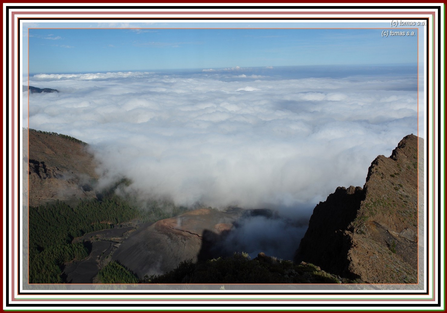
| pico del valle con el mar de nubes |
 |
| pista forestal subimos a la derecha |


 |
| subiendo a montaña colorada |
 |
| teide y mar de nubes |

 |
| pico del valle |


 |
| arco en montaña la negrita |

 |
| llaneando hacia el pico |


 |
| caldera de pedro gil |


 |
| filo de bajada al pico |

 |
| la palma |


No hay comentarios:
Publicar un comentario